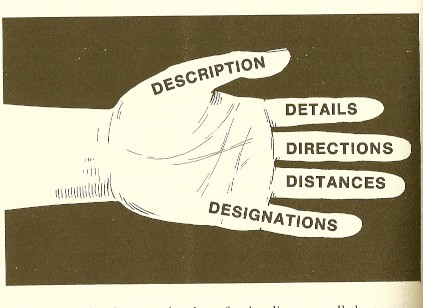
A map will tell you what you need to know about the geographical features of the area by using the five Ds.
Topographic maps
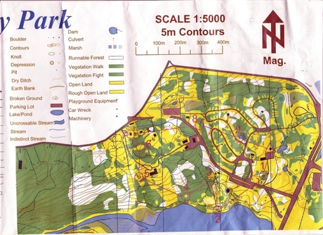 Topographic map of Pippy Park
 - Best for wilderness travellers
- Depict topography by showing contour lines
- Greek meaning 'topos' place and 'graphein' to write or draw
Symbols:
- Black: man-made features
- Blue- water features
- Green- vegetation features
- Brown- elevation features
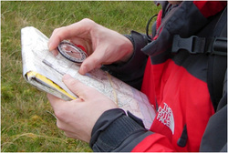
Map Reading by Thumb
 map-reading-by-thumb
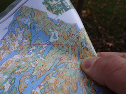
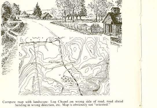
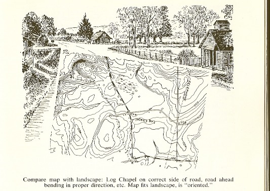
 - Orientate your map in the correct direction
- Fold map to so current location will show
- Place thumb on map with nail pointing in direction of travel
- As you proceed move your thumb along the route
Using this method of map reading reduces error and allows better knowledge of the terrain ahead.
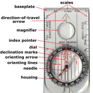
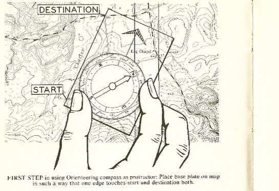
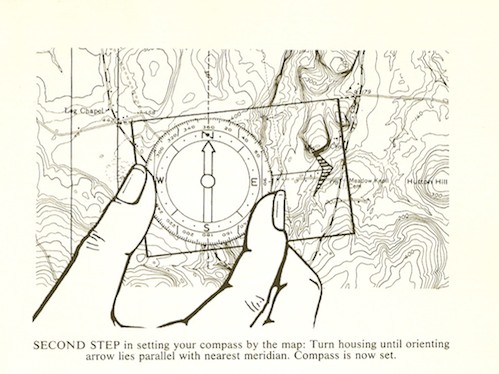
Bearing: the direction from one place to another
- Place the compass on the map with one long edge joining two points of interest
- Rotate housing to align compass orienting lines with north-south lines on map
- Rotate body until red part of needle (north) is in the orienting arrow (red to bed)
What is Orienteering?
(noun) a competitive sport in which participants find their way to various checkpoints across rough country with the aid of a map and compass, the winner being the one with the lowest elapsed time.
When did orienteering start?

- It began in the late 19th century in Sweden originally for military training
- First competition for the Sweden military was in May 1893
- First civilian contest was October 1897 in Oslo, Norway
- Canadian Orienteering Federation (COF) founded and incorporated on December 1, 1967
- 1971- Newfoundland Orienteering Association joins COF
Class taking their new skills to the woods!
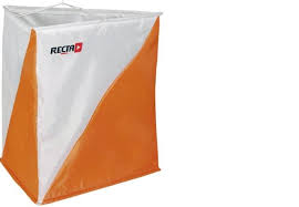
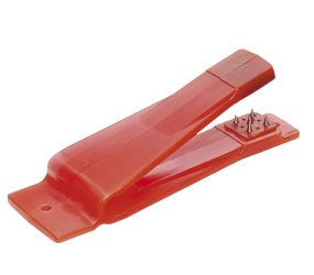
After learning the fundamentals of a map, oriented, and how to take a bearing. The class did an eight control orienteering race in Pippy Park. When you find a control (orange and white flag) your map gets punched (orange thing bellow) to prove you have found the location.
Interesting in orienteering in St.John's? Find the next competition here: http://www.cs.mun.ca/~sjoc/
Interesting in orienteering in St.John's? Find the next competition here: http://www.cs.mun.ca/~sjoc/
Canadian Orienteering Federation Rules
Personal Reflection
The weather remained horrible for the entire day yet the class spirits continued to be high. Orienteering was a lot of fun. With everyone returning to to the shelter safe and sound stories were shared about techniques and strategies used to find the controls. It was neat hearing about the different group approaches because everyones way to solve control locations was slightly different. Groups faced different obstacles due to the route navigated. A few of the groups ended up in a bog with and one person even found themselves up to their knees. The laughter was as loud as thunder when this individual dumbed the dirty water out of their rubber boots.
The class being outside made me think of loose-part theory because it is open-eneded. With imagination and creativity anything is possible because the family area of Pippy Park is a campground which has access to ponds, trails, fields, hills, trees, bushes and flowers. The layout of Pippy Park is nature focused with minimum asphalt. Also the two playgrounds I noticed in the area surrounded was surrounded by grass, trees and bushes with minimum rocks below the equipment. Swedish studies day this setting is most desirable because children's play is not interrupted or in short segments unlike asphalt areas.
This leads me to think if parents/guardians become aware of the loose-part theory that they can also contribute to the enhancement of children's outdoor experiences. This can be done by supplying additional loose-parts like a ball, bucket, rope, etc and making a habit of going outside with these toys.
Sources
Nicholson,S. (1971).How not o cheat children: the theory of loose parts. Landscape Architecture,62, 1 retrieved from
http://s3.amazonaws.com/media-kaboom/docs/documents/pdf/ip/Imagination-Playground-Theory-of-Loose-Parts-Simon-Nicholson.pdf
Burns,B. & Burns, B. (1999). Wilderness navigation finding your way using map, compass, altimeter, & gps.
Seattle: The Mountaineers.
Renfrew, T. (1997). Orienteering. Hong Kong: Human Kinetics
Kjellstrom, B. (1976). Be expert with map & compass. New York: Charles Scribner's Sons.
http://hfweb.co.uk/cpnl/wp-content/uploads/2011/04/Loose_parts1.pdf
http://www.surreycc.gov.uk/__data/assets/pdf_file/0018/514611/Loose-parts-theory-2013.pdf
www.playscotland.org/wp-content/uploads/.../Environmentsforplay.doc
http://www.scholastic.com/teachers/article/staff-workshop-teacher-handout-quotwhysquot-have-it-why-include-loose-parts-playground-0
http://www.readingplay.co.uk/GetAsset.aspx?id=fAAyADUAMgB8AHwARgBhAGwAcwBlAHwAfAA4AHwA0
http://www.nwcg.gov/pms/pubs/475/PMS475_chap6a.pdf